
Every country is influenced by the geographical environment and its people. There is an intimate relationship between human life and the environment ,so it is necessary to learn about the geographical environment in order to know the history of human.

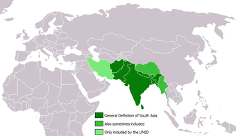
India is a subcontinent which occupies a huge area in the southern part of Asia. India is a Peninsula which means it is surrounded by water on three sides and land on one side. Afghanistan Pakistan China Nepal Bhutan Bangladesh and Myanmar are the countries with which India shares its boundaries.
India consists of 29 states and 6 union territories and one national capital region that is New Delhi. India’s geographical feature consists of the Himalayan mountains the indo-gangetic plain in the north the Deccan Plateau find the coastal region in the south.

The snow capped mountains in the North India includes some of the tallest mountain peaks in the world, which help to preserve the safety and security of India. The Attacks are very few from Northern Himalayan region. The Attacks have been mainly from North Western side through the valley of bolan and Khyber passes.

The indo-gangetic plains are flat and their extremely fertile. In history there are many battles fought for this particular area. Many battles have been fought from time to time to establish control over this area. Usually the dynasty research that established to control over this fertile gangetic plain also established their own Empire.

The river Narmada separates the India into two that is first one is Malwa plateau aur Central Highlands and the Deccan Plateau in the south. The two dynasty who ruled this two areas of Ancient India for the mauryas and the Guptas.
The Indian coastline is vast and structured was 6100 the Eastern coastline is called the Coromandel coast where as the Western is called Konkan and Malabar Coast. The ports of these coastline were attracted romans.

In olden days the foreign trade was carried out through the sea routes as a result port towns florist resulting in the rise of powerful kingdoms in South like the pandyas the cheras and the cholas.

